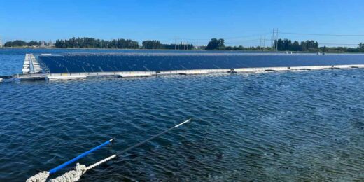
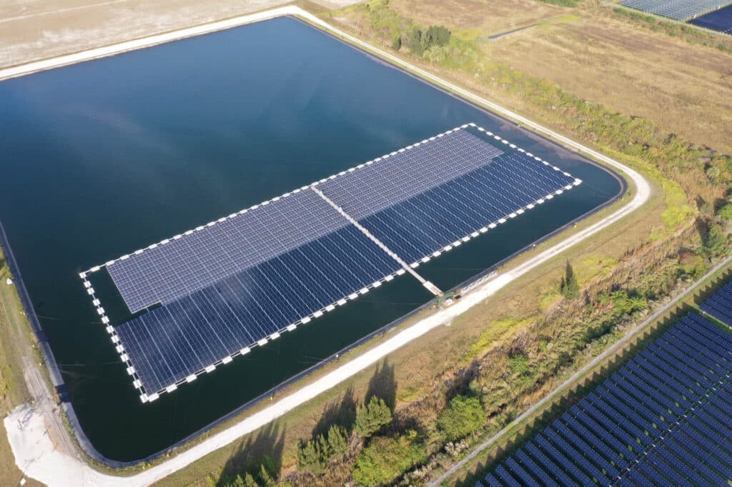
The success of floating solar installations depends on precise planning and informed decision-making. One of the key factors influencing their performance and longevity is mapping water depth. To ensure optimal site selection and design, developers increasingly rely on bathymetric surveys. This advanced method of underwater mapping provides accurate data that helps maximize the efficiency of floating solar systems.
What is a Bathymetric Survey?
A bathymetric survey involves measuring the depth and topography of a water body’s floor using sonar technology or LiDAR. By sending sound waves or lasers to the terrain and measuring their return time, it creates detailed maps of underwater features. These surveys are widely used in marine science, navigation, and now, renewable energy projects such as floating solar.
Why Water Depth Matters for Floating Solar
Understanding the depth of a water body is essential for designing floating solar systems that are efficient, stable, and sustainable. Depth impacts various aspects of the installation, including:
Anchoring Systems: Proper anchoring ensures the stability of floating arrays. Bathymetric data helps identify suitable locations for anchor placement, ensuring they are securely positioned.
Environmental Impact: Shallow areas may be more susceptible to ecological disturbances. Accurate depth mapping ensures that installations minimize disruptions to aquatic ecosystems.
System Longevity: Areas with significant depth variation or underwater obstacles can lead to wear and tear on floating structures if not accounted for. By avoiding such zones, operators can reduce maintenance costs and prolong system life.
Steps in Conducting a Bathymetric Survey for Floating Solar
Companies that specialize in bathymetry studies each will have their own methodology, but a basic understanding will include:
- Preliminary Planning: Define the survey area and determine the equipment needed based on water body characteristics.
- Data Collection: Deploy sonar-equipped vessels or drones to collect depth data. GPS integration ensures spatial accuracy.
- Data Analysis: Process the collected data to create 3D maps of the underwater terrain.
- Application: Use the bathymetric map to guide site selection, anchoring design, and overall system layout.
Accurate depth data is crucial for optimizing the performance of floating solar systems, ensuring they are positioned for maximum efficiency. This data also plays a vital role in risk reduction by identifying and mitigating potential underwater hazards that could cause structural damage. Additionally, mapping sensitive zones allows developers to comply with environmental regulations, protecting delicate ecosystems. By informing thorough planning, this precise depth data ultimately translates to significant cost savings over the system’s lifespan, minimizing both installation and maintenanceexpenses.
At AccuSolar, we understand the importance of thorough planning in floating solar projects. Our commitment to integrating cutting-edge technology like bathymetry surveys ensures that your project is designed for maximum efficiency and sustainability. We work closely with companies that perform all responsibilities of a successful floating solar project. Contact us for more information on floating solar systems.